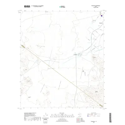
2019 Map of Toyahvale
USGS Topo · Published 2019About this map
San Solomon Spring and other vital desert water sources define this Chihuahuan Desert landscape near the Reeves and Jeff Davis county line. The settlement of Toyahvale serves as a gateway to this spring-fed oasis, where a complex network of irrigation infrastructure including the Main Canal, Giffin Canal, and Phantom Lake Canal distributes water across the arid plains. These human-made waterways contrast sharply with natural ephemeral features like Toyah Creek and Moore Tank Draw.
Find a feature on this map
40 named features on this map. Tap any name to fly to it.
Don’t see what you’re looking for? This feature index may not catch every label — zoom into the map to look around manually.
Map Details
Editions of this 2019 Toyahvale Map
This is the sole edition of this map. No revisions or reprints were ever made.
Other maps of this area

1894 · Fort Davis
USGS Topo · 1:125,000

1897 · Fort Davis
USGS Topo · 1:125,000

1921 · Toyah
USGS Topo · 1:125,000

1954 · Pecos
USGS Topo · 1:250,000

1954 · Fort Stockton
USGS Topo · 1:250,000

1955 · Saragosa
USGS Topo · 1:62,500

1957 · Pecos
USGS Topo · 1:250,000

1958 · Fort Stockton
USGS Topo · 1:250,000
1970 · Sotol Hill
USGS Topo · 1:24,000
1970 · Saragosa
USGS Topo · 1:24,000