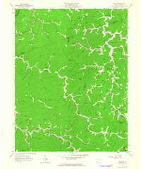
1963 Map of Trace
USGS Topo · Published 1964About this map
Twelvepole Creek and its myriad forks dominate this rugged landscape at the intersection of Lincoln, Logan, Mingo, and Wayne Counties. In the early 1960s, the region's economy is clearly defined by natural gas extraction, with numerous Gas Wells and a major Pipeline cutting through the narrow valleys. The settlement pattern follows the water, with the community of Dingess and the Trace post office serving as local hubs. Genealogists will find a high density of family-named landmarks and institutions, such as the Hugh Dingess Sch, Sol Adams Cem, and Mullins Cem, which reflect the deep-rooted kinship ties of these Appalachian hollows. The map also documents a network of rural education that was still active or recently transitioned, evidenced by several scattered schoolhouses like Dalton Sch No 3 and Frances Creek Sch.
Find a feature on this map
87 named features on this map. Tap any name to fly to it.
Don’t see what you’re looking for? This feature index may not catch every label — zoom into the map to look around manually.
Map Details
Editions of this 1963 Trace Map
2 editions found

Other maps of this area

1887 · Warfield
USGS Topo · 1:125,000

1891 · Warfield
USGS Topo · 1:125,000

1892 · Huntington
USGS Topo · 1:125,000

1898 · Huntington
USGS Topo · 1:125,000

1902 · Midkiff
USGS Topo · 1:62,500

1907 · Midkiff
USGS Topo · 1:62,500

1909 · Wayne
USGS Topo · 1:62,500

1909 · Midkiff
USGS Topo · 1:62,500

1910 · Holden
USGS Topo · 1:48,000

1910 · Naugatuck
USGS Topo · 1:48,000