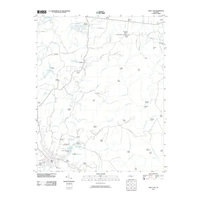
2010 Map of Tracy City
USGS Topo · Published 2010About this map
Tracy City and the neighboring settlement of Coalmont sit atop the Cumberland Plateau, where the landscape is defined by the Tennessee Valley Divide. This 2010 survey illustrates a region where water management and industrial infrastructure are central to the community, marked by numerous small reservoirs such as Grundy Lake Number One and Grundy Lake Number Two, each with its own dam. The complex geography of the area is further evidenced by natural features like Knight Gulf and Sewanee Gulf, which cut through the high tableland.
Find a feature on this map
118 named features on this map. Tap any name to fly to it.
Don’t see what you’re looking for? This feature index may not catch every label — zoom into the map to look around manually.
Map Details
Editions of this 2010 Tracy City Map
This is the sole edition of this map. No revisions or reprints were ever made.
Other maps of this area

1895 · Sewanee
USGS Topo · 1:125,000

1936 · Palmer
USGS Topo · 1:24,000

1936 · Whitwell
USGS Topo · 1:24,000

1936 · Burrow Cove
USGS Topo · 1:24,000

1936 · Tracy City
USGS Topo · 1:24,000

1936 · Monteagle
USGS Topo · 1:24,000

1936 · White City
USGS Topo · 1:24,000

1936 · Cane Hollow
USGS Topo · 1:24,000

1943 · Mc Minnville
USGS Topo · 1:100,000
1946 · Whitwell
USGS Topo · 1:24,000