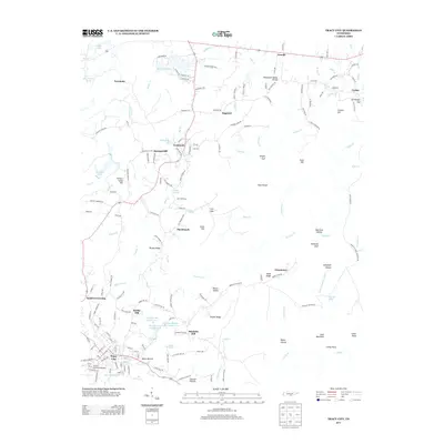
2013 Map of Tracy City
USGS Topo · Published 2013About this map
Tracy City and the surrounding highlands of the Cumberland Plateau in Tennessee are captured in this 2013 topographic survey. The landscape is defined by its dramatic relief, featuring deep gorges like the Sewanee Gulf and Knight Gulf, alongside prominent ridges such as Bone Ridge and Brushy Ridge. The area's coal mining history is subtly present in place names like Coalmont and Black Bottom, while recreational and community spaces are represented by the Grundy County Fairgrounds and the series of lakes including Grundy Lake Number One, Grundy Lake Number Two, and Grundy Lake Number Four. Small settlements such as Gruetli, Dogtown, and Sweeton Hill dot the terrain, connected by a network of creeks like Ranger Cr and the Little Sequatchie River. The Tennessee Valley Divide snakes through the region, marking a significant geographic boundary amidst the hollows and hills like Shadrick Hill and Cane Mountain.
Find a feature on this map
175 named features on this map. Tap any name to fly to it.
Don’t see what you’re looking for? This feature index may not catch every label — zoom into the map to look around manually.
Map Details
Editions of this 2013 Tracy City Map
This is the sole edition of this map. No revisions or reprints were ever made.
Other maps of this area

1895 · Sewanee
USGS Topo · 1:125,000

1936 · Palmer
USGS Topo · 1:24,000

1936 · Whitwell
USGS Topo · 1:24,000

1936 · Burrow Cove
USGS Topo · 1:24,000

1936 · Tracy City
USGS Topo · 1:24,000

1936 · Monteagle
USGS Topo · 1:24,000

1936 · White City
USGS Topo · 1:24,000

1936 · Cane Hollow
USGS Topo · 1:24,000

1943 · Mc Minnville
USGS Topo · 1:100,000
1946 · Whitwell
USGS Topo · 1:24,000