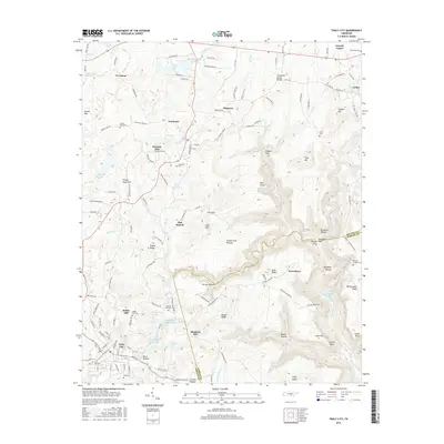
2016 Map of Tracy City
USGS Topo · Published 2016About this map
Tracy City and the surrounding plateau communities of Gruetli-Laager, Coalmont, and Dogtown define the human landscape of this survey. Situated atop the Cumberland Plateau, the region exhibits a settlement pattern shaped by the undulating terrain of the Tennessee Valley Divide. Notable water features such as Grundy Lake Number One and Big Creek Utility Lake are central to the upland geography, while deep incisions like Sewanee Gulf and Knight Gulf mark the edges of the plateau. For genealogists and local historians, the map is particularly rich in family-named landmarks and cemeteries, including the Hobbs Hill Cem, Orange Hill Cem, and Fults Cem. The layout of local roads, such as Lockhart Town Rd and Company Farm Rd, provides a clear view of how these high-elevation settlements were connected before the modern era of expansion.
Find a feature on this map
172 named features on this map. Tap any name to fly to it.
Don’t see what you’re looking for? This feature index may not catch every label — zoom into the map to look around manually.
Map Details
Editions of this 2016 Tracy City Map
This is the sole edition of this map. No revisions or reprints were ever made.
Other maps of this area

1895 · Sewanee
USGS Topo · 1:125,000

1936 · Palmer
USGS Topo · 1:24,000

1936 · Whitwell
USGS Topo · 1:24,000

1936 · Burrow Cove
USGS Topo · 1:24,000

1936 · Tracy City
USGS Topo · 1:24,000

1936 · Monteagle
USGS Topo · 1:24,000

1936 · White City
USGS Topo · 1:24,000

1936 · Cane Hollow
USGS Topo · 1:24,000

1943 · Mc Minnville
USGS Topo · 1:100,000
1946 · Whitwell
USGS Topo · 1:24,000