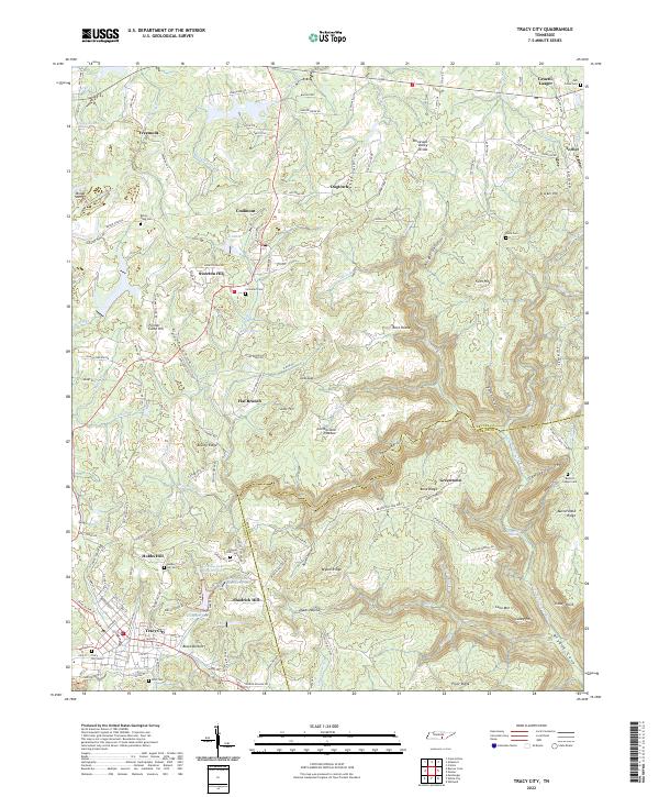
2022 Map of Tracy City
USGS Topo · Published 2022About this map
Tracy City sits atop the southern Cumberland Plateau, marking a landscape where the industrial history of the South Cumberland coalfields meets the dramatic geography of the Sewanee Gulf. The terrain is defined by its high ridges, such as Brushy Ridge and Pryor Ridge, and the deep hollows that drain into the Little Sequatchie River. The spatial distribution of settlements like Coalmont, Sweeton Hill, and Freemont reveals the region’s development along the plateau's summits. Several small bodies of water, including Lake Echo and the numbered reservoirs like Grundy Lake Number Two, are clustered near the primary residential centers. For those researching family history, numerous burial grounds are scattered throughout the area, including Tracy City Cem, Orange Hill Cem, and the remote Burkett Chapel Cem located near the edge of the Tennessee Valley Divide.
Find a feature on this map
163 named features on this map. Tap any name to fly to it.
Don’t see what you’re looking for? This feature index may not catch every label — zoom into the map to look around manually.
Map Details
Editions of this 2022 Tracy City Map
This is the sole edition of this map. No revisions or reprints were ever made.
Other maps of this area

1895 · Sewanee
USGS Topo · 1:125,000

1936 · Palmer
USGS Topo · 1:24,000

1936 · Whitwell
USGS Topo · 1:24,000

1936 · Burrow Cove
USGS Topo · 1:24,000

1936 · Tracy City
USGS Topo · 1:24,000

1936 · Monteagle
USGS Topo · 1:24,000

1936 · White City
USGS Topo · 1:24,000

1936 · Cane Hollow
USGS Topo · 1:24,000

1943 · Mc Minnville
USGS Topo · 1:100,000
1946 · Whitwell
USGS Topo · 1:24,000