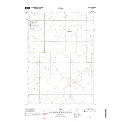
2019 Map of Tracy East
USGS Topo · Published 2019About this map
Tracy anchors the northwest corner of this agricultural landscape, situated atop the Coteau des Prairies, a high plateau that dramatically shapes the local hydrology. The town's layout is clearly defined by its residential grid and the Tracy Municipal Airport to its north. This 2019 survey documents a terrain dominated by section-line roads and the intricate drainage network of the northern plains. Waterways such as Lone Tree Cr and Plum Cr meander across the prairie, while the engineered path of Judicial Ditch Number Twenty A highlights the long-standing efforts to manage surface water for farming. For local historians, the Tracy Cem remains a significant landmark just south of the town center, marking the community's ancestral grounds within a landscape of expansive fields and rural homesteads.
Find a feature on this map
43 named features on this map. Tap any name to fly to it.
Don’t see what you’re looking for? This feature index may not catch every label — zoom into the map to look around manually.
Map Details
Editions of this 2019 Tracy East Map
This is the sole edition of this map. No revisions or reprints were ever made.
Other maps of this area

1953 · New Ulm
USGS Topo · 1:250,000

1957 · New Ulm
USGS Topo · 1:250,000

1958 · New Ulm
USGS Topo · 1:250,000

1962 · Milroy SE
USGS Topo · 1:24,000

1962 · Amiret
USGS Topo · 1:24,000

1967 · New Ulm
USGS Topo · 1:250,000

1967 · Walnut Grove
USGS Topo · 1:24,000

1967 · Tracy East
USGS Topo · 1:24,000
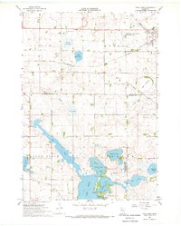
1967 · Tracy West
USGS Topo · 1:24,000

1967 · Dovray
USGS Topo · 1:24,000