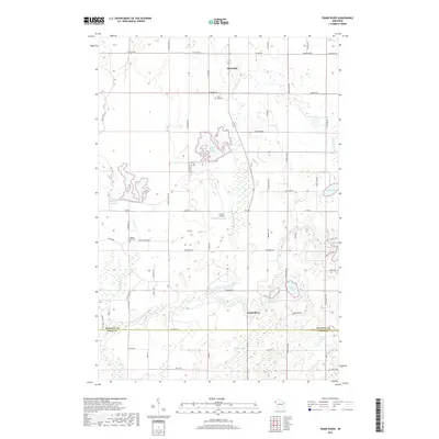
2018 Map of Trade River
USGS Topo · Published 2018About this map
The N Fork Trade River and the main stem of the Trade River dominate this portion of the Wisconsin landscape, winding through a network of wetlands and artificial impoundments. Significant water management is evident in the presence of the Canute Creek Flowage, Daniels Flowage, and Logging Cr Flowage 6, which reflect the region's history of hydraulic control for local industry or conservation. The small settlements of Branstad and Trade River serve as local hubs, connected by a grid of rural roads including Range Line Rd and Assembly Rd.
Find a feature on this map
66 named features on this map. Tap any name to fly to it.
Don’t see what you’re looking for? This feature index may not catch every label — zoom into the map to look around manually.
Map Details
Editions of this 2018 Trade River Map
This is the sole edition of this map. No revisions or reprints were ever made.
Other maps of this area

1950 · Rush City
USGS Topo · 1:48,000

1950 · Grantsburg
USGS Topo · 1:48,000

1951 · Milltown
USGS Topo · 1:48,000

1953 · Stillwater
USGS Topo · 1:250,000

1955 · Rush City
USGS Topo · 1:62,500

1955 · Milltown
USGS Topo · 1:62,500

1955 · Stillwater
USGS Topo · 1:250,000

1958 · Stillwater
USGS Topo · 1:250,000

1961 · Pine City
USGS Topo · 1:62,500

1962 · Grantsburg
USGS Topo · 1:62,500