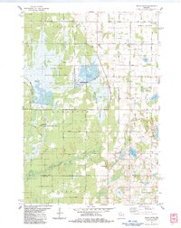
1983 Map of Trade River
USGS Topo · Published 1983About this map
Fish Lake State Wildlife Area dominates the northwestern portion of this 1980s-era landscape, a region defined by extensive flowages and glacial water bodies. The terrain reflects a complex hydrologic network where the North Fork Trade River and South Fork Trade River converge near the settlement of Trade River. This area, encompassing parts of Grantsburg, Anderson, and Trade Lake, shows a transition from managed wildlife habitats to agricultural and residential parcels. Local history is anchored by rural institutions like Bethany Ch, Wood River Tabernacle, and the St Olaf Cem. The road network, featuring names like Jimmy Carter Road and Alstad Road, traces the boundaries of old family landholdings and provides access to fishing and recreation at Big Trade Lake and Daniels Flowage.
Find a feature on this map
55 named features on this map. Tap any name to fly to it.
Don’t see what you’re looking for? This feature index may not catch every label — zoom into the map to look around manually.
Map Details
Editions of this 1983 Trade River Map
This is the sole edition of this map. No revisions or reprints were ever made.
Other maps of this area

1950 · Rush City
USGS Topo · 1:48,000

1950 · Grantsburg
USGS Topo · 1:48,000

1951 · Milltown
USGS Topo · 1:48,000

1953 · Stillwater
USGS Topo · 1:250,000

1955 · Rush City
USGS Topo · 1:62,500

1955 · Milltown
USGS Topo · 1:62,500

1955 · Stillwater
USGS Topo · 1:250,000

1958 · Stillwater
USGS Topo · 1:250,000

1961 · Pine City
USGS Topo · 1:62,500

1962 · Grantsburg
USGS Topo · 1:62,500