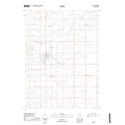
2018 Map of Traer
USGS Topo · Published 2018About this map
Traer serves as the central hub of this Tama County landscape, situated where the northern prairies meet the drainage networks of the Iowa River valley. The town's grid is bounded by a series of cemeteries that anchor the local heritage, including Buckingham Cem to the north and Saint Paul's Catholic Cem on the southern edge. The Traer Municipal Airport sits just north of the residential center, reflecting the modernization of this agricultural community.
Find a feature on this map
39 named features on this map. Tap any name to fly to it.
Don’t see what you’re looking for? This feature index may not catch every label — zoom into the map to look around manually.
Map Details
Editions of this 2018 Traer Map
This is the sole edition of this map. No revisions or reprints were ever made.
Other maps of this area

1954 · Waterloo
USGS Topo · 1:250,000

1955 · Waterloo
USGS Topo · 1:250,000

1963 · Buckingham
USGS Topo · 1:24,000

1963 · Eagle Center
USGS Topo · 1:24,000

1971 · Gladbrook NE
USGS Topo · 1:24,000
1971 · Elberon
USGS Topo · 1:24,000
1971 · Dysart
USGS Topo · 1:24,000

1971 · Traer
USGS Topo · 1:24,000
1971 · Clutier
USGS Topo · 1:24,000

1971 · Reinbeck
USGS Topo · 1:24,000