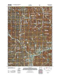
2011 Map of Trail
USGS Topo · Published 2011About this map
The Rogue River defines the southern reach of this landscape, where the settlement of Trail sits near the confluence of Trail Creek. This 2011 survey captures the area's transition from riverfront residential developments like those along Country Club Dr and Danconia Dr to the steep, forested elevations of the north. Landmarks of civic and resource management are evident at the Trail Post Office and the Trail Forest Service Facility.
Find a feature on this map
61 named features on this map. Tap any name to fly to it.
Don’t see what you’re looking for? This feature index may not catch every label — zoom into the map to look around manually.
Map Details
Editions of this 2011 Trail Map
This is the sole edition of this map. No revisions or reprints were ever made.
Other maps of this area

1891 · Ashland
USGS Topo · 1:250,000

1893 · Ashland
USGS Topo · 1:250,000

1897 · Ashland
USGS Topo · 1:250,000

1943 · Trail
USGS Topo · 1:62,500

1944 · Tiller
USGS Topo · 1:62,500

1944 · Abbott Butte
USGS Topo · 1:62,500

1947 · Abbott Butte
USGS Topo · 1:62,500

1954 · Butte Falls
USGS Topo · 1:62,500

1955 · Medford
USGS Topo · 1:250,000

1957 · Medford
USGS Topo · 1:250,000