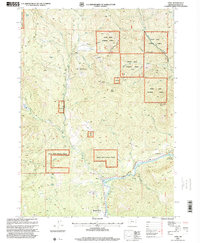
1997 Map of Trail
USGS Topo · Published 2000About this map
The Rogue River dominates this landscape, winding southward toward the settlement of Shady Cove. This 1997 revision, produced by the USDA Forest Service and the USGS, documents a rugged corridor where timberlands of the Rogue River National Forest meet the river-bottom communities. To the east, Rogue Elk and the nearby Rogue Elk County Park mark a significant bend in the river, while smaller features like the Trail Creek Riffle, Cable Hole, and Boil Hole indicate a waterway shaped by both geology and recreational use.
Find a feature on this map
41 named features on this map. Tap any name to fly to it.
Don’t see what you’re looking for? This feature index may not catch every label — zoom into the map to look around manually.
Map Details
Editions of this 1997 Trail Map
This is the sole edition of this map. No revisions or reprints were ever made.
Other maps of this area

1891 · Ashland
USGS Topo · 1:250,000

1893 · Ashland
USGS Topo · 1:250,000

1897 · Ashland
USGS Topo · 1:250,000

1943 · Trail
USGS Topo · 1:62,500

1944 · Tiller
USGS Topo · 1:62,500

1944 · Abbott Butte
USGS Topo · 1:62,500

1947 · Abbott Butte
USGS Topo · 1:62,500

1954 · Butte Falls
USGS Topo · 1:62,500

1955 · Medford
USGS Topo · 1:250,000

1957 · Medford
USGS Topo · 1:250,000