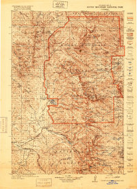
1957 Map of Trail Mountain
USGS Topo · Published 1962About this map
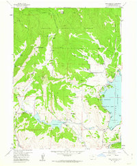
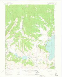
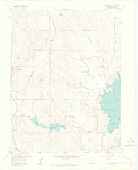
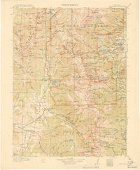
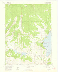
Arapaho National Forest defines the western landscape of this mid-century survey, where timber and ranching interests met the growing demand for water management. The map documents a rugged terrain marked by the Lumber Camp and established livestock operations like the Slash J Slash Ranch and Miller Hereford Ranch. At the heart of the area, the engineering of the Willow Creek Reservoir is captured shortly after its completion, showcasing the complex network of the Pump Canal and Blinte Highline Ditch designed to redirect alpine flows.
Find a feature on this map
39 named features on this map. Tap any name to fly to it.
Don’t see what you’re looking for? This feature index may not catch every label — zoom into the map to look around manually.
Map Details
Editions of this 1957 Trail Mountain Map
5 editions found

Other maps of this area
1915 · Longs Peak
USGS Topo · 1:125,000
1919 · Rocky Mountain National Park
USGS Topo · 1:125,000

1954 · Greeley
USGS Topo · 1:250,000

1954 · Craig
USGS Topo · 1:250,000
1956 · Radial Mountain
USGS Topo · 1:24,000
1956 · Rand
USGS Topo · 1:62,500

1957 · Craig
USGS Topo · 1:250,000

1957 · Greeley
USGS Topo · 1:250,000
1957 · Bowen Mountain
USGS Topo · 1:24,000
1957 · Trail Mountain
USGS Topo · 1:24,000