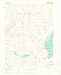
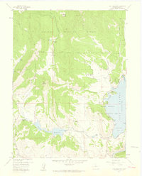
1957 Map of Trail Mountain
USGS Topo · Published 1963About this map
Willow Creek Reservoir and the expansive waters of Granby Lake anchor this mid-century look at the Colorado high country. The landscape is defined by its water management and recreational infrastructure, featuring several irrigation projects like the Bunte Highline Ditch and the Red Valley Ditch, alongside a Pumping Station and multiple gaging stations. This era shows the early development of the Shadow Mountain National Recreation Area, complete with its Ranger Station Campground at Fish Bay.
Find a feature on this map
41 named features on this map. Tap any name to fly to it.
Don’t see what you’re looking for? This feature index may not catch every label — zoom into the map to look around manually.
Map Details
Editions of this 1957 Trail Mountain Map
5 editions found
Other maps of this area

1915 · Longs Peak
USGS Topo · 1:125,000

1919 · Rocky Mountain National Park
USGS Topo · 1:125,000

1954 · Greeley
USGS Topo · 1:250,000

1954 · Craig
USGS Topo · 1:250,000

1956 · Radial Mountain
USGS Topo · 1:24,000

1956 · Rand
USGS Topo · 1:62,500

1957 · Craig
USGS Topo · 1:250,000

1957 · Greeley
USGS Topo · 1:250,000

1957 · Bowen Mountain
USGS Topo · 1:24,000
1957 · Trail Mountain
USGS Topo · 1:24,000