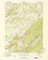
1954 Map of Tranquility
USGS Topo · Published 1956About this map
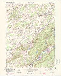
Allamuchy Mountain dominates the center of this landscape, rising above the Pequest River valley where the Lehigh and Hudson River Railroad and Lackawanna Railroad converge. The mid-century geography reveals a dense network of early settlements and spiritual centers, such as Yellow Frame Church, Quaker Church, and the village of Tranquility. To the south, the industrial and transport hub of Hackettstown serves as a gateway to the region, situated near the Musconetcong River.
Find a feature on this map
56 named features on this map. Tap any name to fly to it.
Don’t see what you’re looking for? This feature index may not catch every label — zoom into the map to look around manually.
Map Details
Editions of this 1954 Tranquility Map
5 editions found
Other maps of this area

1888 · Franklin
USGS Topo · 1:62,500

1888 · Hackettstown
USGS Topo · 1:62,500

1888 · Lake Hopatcong
USGS Topo · 1:62,500

1891 · Wallpack
USGS Topo · 1:62,500

1893 · Wallpack
USGS Topo · 1:62,500

1894 · Hackettstown
USGS Topo · 1:62,500

1894 · Lake Hopatcong
USGS Topo · 1:62,500

1894 · Franklin
USGS Topo · 1:62,500

1897 · Franklin
USGS Topo · 1:62,500

1898 · Lake Hopatcong
USGS Topo · 1:62,500