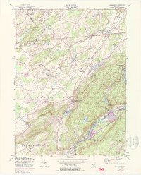
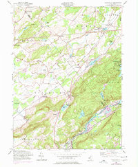
1954 Map of Tranquility
USGS Topo · Published 1988About this map
The Musconetcong River and Pequest River valleys define this northern New Jersey landscape, which was revised in 1954 to show postwar updates. The map highlights the rural character of southeastern Sussex and northeastern Warren counties, where small settlements like Tranquility and Allamuchy anchor the farming and early recreational landscape. Significant transportation corridors, including the Erie Lackawanna and the Lehigh and Hudson River railroads, intersect the terrain, illustrating the region's importance as a transit hub between the Delaware Water Gap and the New York metropolitan area.
Find a feature on this map
53 named features on this map. Tap any name to fly to it.
Don’t see what you’re looking for? This feature index may not catch every label — zoom into the map to look around manually.
Map Details
Editions of this 1954 Tranquility Map
5 editions found
Other maps of this area

1888 · Franklin
USGS Topo · 1:62,500

1888 · Hackettstown
USGS Topo · 1:62,500

1888 · Lake Hopatcong
USGS Topo · 1:62,500

1891 · Wallpack
USGS Topo · 1:62,500

1893 · Wallpack
USGS Topo · 1:62,500

1894 · Hackettstown
USGS Topo · 1:62,500

1894 · Lake Hopatcong
USGS Topo · 1:62,500

1894 · Franklin
USGS Topo · 1:62,500

1897 · Franklin
USGS Topo · 1:62,500

1898 · Lake Hopatcong
USGS Topo · 1:62,500