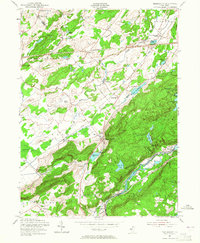
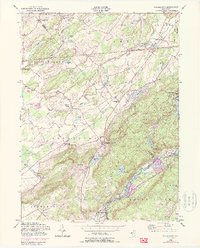
1954 Map of Tranquility
USGS Topo · Published 1965About this map
Tranquility and the surrounding townships of Allamuchy and Frelinghuysen are defined by a complex intersection of early New Jersey transportation and water resources. The landscape is deeply tied to the movement of the Pequest River and the Musconetcong River, which provided the foundation for local settlement and industry. Evidence of 19th-century infrastructure remains prominent, with the Delaware Lackawanna and Western and the Lehigh and Hudson River railroads cutting through the valley. These corridors connected isolated hamlets like Greendell and Johnsonburg to larger markets, while local landmarks such as Quaker Church and Tranquility Ch served as the social heart of these rural communities.
Find a feature on this map
51 named features on this map. Tap any name to fly to it.
Don’t see what you’re looking for? This feature index may not catch every label — zoom into the map to look around manually.
Map Details
Editions of this 1954 Tranquility Map
5 editions found
Other maps of this area

1888 · Franklin
USGS Topo · 1:62,500

1888 · Hackettstown
USGS Topo · 1:62,500

1888 · Lake Hopatcong
USGS Topo · 1:62,500

1891 · Wallpack
USGS Topo · 1:62,500

1893 · Wallpack
USGS Topo · 1:62,500

1894 · Hackettstown
USGS Topo · 1:62,500

1894 · Lake Hopatcong
USGS Topo · 1:62,500

1894 · Franklin
USGS Topo · 1:62,500

1897 · Franklin
USGS Topo · 1:62,500

1898 · Lake Hopatcong
USGS Topo · 1:62,500