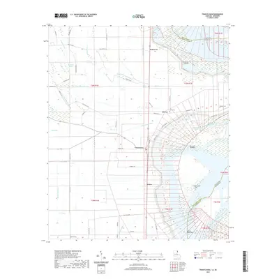
2020 Map of Transylvania
USGS Topo · Published 2020About this map
Mississippi River alluvial plains define this landscape along the Louisiana-Mississippi border, where the water has shaped both the land and its human settlement. The community of Transylvania sits central to a grid of agricultural drainage, including Ditch Number Eight and Ditch Number Nine. The river's influence is evident in features like the Hollybrook Crevasse and the shifting shoreline banks of Atherton Towhead and Cottonwood Bar.
Find a feature on this map
65 named features on this map. Tap any name to fly to it.
Don’t see what you’re looking for? This feature index may not catch every label — zoom into the map to look around manually.
Map Details
Editions of this 2020 Transylvania Map
This is the sole edition of this map. No revisions or reprints were ever made.
Other maps of this area

1909 · Baxter Bayou
USGS Topo · 1:24,000

1909 · Lake Providence
USGS Topo · 1:24,000

1911 · Lake Providence
USGS Topo · 1:31,680

1911 · Baxter Bayou
USGS Topo · 1:24,000

1914 · Baxter Bayou
USGS Topo · 1:31,680

1935 · Oak Grove
USGS Topo · 1:62,500

1939 · Alsatia
USGS Topo · 1:62,500

1939 · Mayersville
USGS Topo · 1:62,500

1955 · Jackson
USGS Topo · 1:250,000

1958 · Oak Grove
USGS Topo · 1:62,500