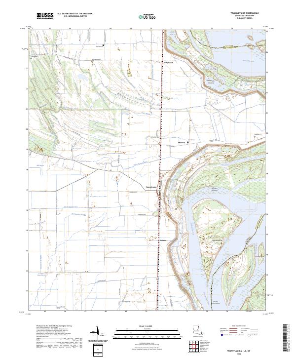
2024 Map of Transylvania
USGS Topo · Published 2024About this map
The Mississippi River dominates the eastern edge of this East Carroll Parish landscape, defining the border between Louisiana and Mississippi at Salem Bend. The interior terrain is characterized by a sophisticated drainage network of bayous and numbered ditches, such as Ditch Number One and Ditch Number Eight, which supported the agricultural development of the region. The settlements of Transylvania, Atherton, and Grimes are clustered along the river corridor, linked by Levee Rd and Kirby Rd. Local history and genealogy are anchored by several family and community landmarks, including St John Church and the Morning Star Cem at Bearwallow. Geologic activity on the river is evident in features like Hollybrook Crevasse and the shifting lands of Atherton Towhead and Cottonwood Bar.
Find a feature on this map
66 named features on this map. Tap any name to fly to it.
Don’t see what you’re looking for? This feature index may not catch every label — zoom into the map to look around manually.
Map Details
Editions of this 2024 Transylvania Map
This is the sole edition of this map. No revisions or reprints were ever made.
Other maps of this area

1909 · Baxter Bayou
USGS Topo · 1:24,000

1909 · Lake Providence
USGS Topo · 1:24,000

1911 · Lake Providence
USGS Topo · 1:31,680

1911 · Baxter Bayou
USGS Topo · 1:24,000

1914 · Baxter Bayou
USGS Topo · 1:31,680

1935 · Oak Grove
USGS Topo · 1:62,500

1939 · Alsatia
USGS Topo · 1:62,500

1939 · Mayersville
USGS Topo · 1:62,500

1955 · Jackson
USGS Topo · 1:250,000

1958 · Oak Grove
USGS Topo · 1:62,500