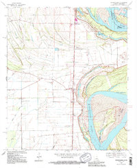
1994 Map of Transylvania
USGS Topo · Published 1995About this map
The Mississippi River creates a dynamic eastern boundary for East Carroll Parish, where the legacy of historic flooding is etched into the landscape at Hollybrook Crevasse. This bend in the river is defined by heavy siltation and shifts, evidenced by the broad Cottonwood Bar and the Transylvania Chute. Inland from the massive Levee system, the alluvial plain is crisscrossed by a network of drainage ditches and slow-moving bayous like Sandy Bayou and Otter Bayou.
Find a feature on this map
41 named features on this map. Tap any name to fly to it.
Don’t see what you’re looking for? This feature index may not catch every label — zoom into the map to look around manually.
Map Details
Editions of this 1994 Transylvania Map
This is the sole edition of this map. No revisions or reprints were ever made.
Other maps of this area

1909 · Baxter Bayou
USGS Topo · 1:24,000

1909 · Lake Providence
USGS Topo · 1:24,000

1911 · Lake Providence
USGS Topo · 1:31,680

1911 · Baxter Bayou
USGS Topo · 1:24,000

1914 · Baxter Bayou
USGS Topo · 1:31,680

1935 · Oak Grove
USGS Topo · 1:62,500

1939 · Alsatia
USGS Topo · 1:62,500

1939 · Mayersville
USGS Topo · 1:62,500

1955 · Jackson
USGS Topo · 1:250,000

1958 · Oak Grove
USGS Topo · 1:62,500