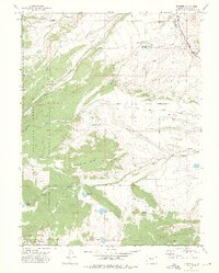
1972 Map of Trapper
USGS Topo · Published 1975About this map
Egeria Park serves as a central drainage basin in this 1970s landscape, where the Denver and Rio Grande Western railroad corridor follows the narrow valley of Chimney Creek. The map documents a highly managed water system essential for high-altitude ranching and conservation, featuring numerous upland catchments such as Sterner Reservoir, Crossan Reservoir, and the Egeria Creek Reservoir.
Find a feature on this map
35 named features on this map. Tap any name to fly to it.
Don’t see what you’re looking for? This feature index may not catch every label — zoom into the map to look around manually.
Map Details
Editions of this 1972 Trapper Map
3 editions found
Other maps of this area

1927 · Glenwood Springs
USGS Topo · 1:125,000

1930 · Glenwood Springs
USGS Topo · 1:125,000

1954 · Craig
USGS Topo · 1:250,000

1957 · Craig
USGS Topo · 1:250,000

1957 · Leadville
USGS Topo · 1:250,000

1958 · Craig
USGS Topo · 1:250,000

1959 · Leadville
USGS Topo · 1:250,000

1960 · Leadville
USGS Topo · 1:250,000

1960 · Craig
USGS Topo · 1:250,000

1962 · Leadville
USGS Topo · 1:250,000