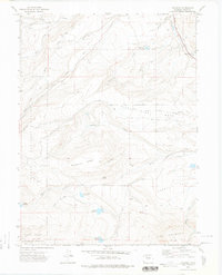
1972 Map of Trapper
USGS Topo · Published 1975About this map
The Denver and Rio Grande Western railroad corridor follows the winding path of Chimney Creek and Watson Creek as it passes through the small settlement of Trapper in the early 1970s. This landscape is defined by its sophisticated water management systems, including the Roaring Fork Ditch, Moore Park Ditch, and Five Pine Ditch, which redirect flow across the high country. These man-made improvements support ranching and local infrastructure across the broad reaches of Egeria Park and Five Pine Mesa.
Find a feature on this map
36 named features on this map. Tap any name to fly to it.
Don’t see what you’re looking for? This feature index may not catch every label — zoom into the map to look around manually.
Map Details
Editions of this 1972 Trapper Map
3 editions found
Other maps of this area

1927 · Glenwood Springs
USGS Topo · 1:125,000

1930 · Glenwood Springs
USGS Topo · 1:125,000

1954 · Craig
USGS Topo · 1:250,000

1957 · Craig
USGS Topo · 1:250,000

1957 · Leadville
USGS Topo · 1:250,000

1958 · Craig
USGS Topo · 1:250,000

1959 · Leadville
USGS Topo · 1:250,000

1960 · Leadville
USGS Topo · 1:250,000

1960 · Craig
USGS Topo · 1:250,000

1962 · Leadville
USGS Topo · 1:250,000