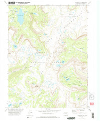
1977 Map of Trappers Lake
USGS Topo · Published 1978About this map
The Flat Tops dominate this 1970s landscape, where high-altitude plateaus meet the headwaters of the South Fork White River. The region is defined by its deep wilderness character, preserved within the Flat Tops Wilderness and spanning parts of the White River National Forest and Routt National Forest. Remote landmarks like the Chinese Wall and the natural basin of the Amphitheatre frame a landscape dotted with numerous glacial lakes, including Trappers Lake and its smaller neighbors, Little Trappers Lake and Coffin Lake.
Find a feature on this map
35 named features on this map. Tap any name to fly to it.
Don’t see what you’re looking for? This feature index may not catch every label — zoom into the map to look around manually.
Map Details
Editions of this 1977 Trappers Lake Map
3 editions found
Other maps of this area

1927 · Glenwood Springs
USGS Topo · 1:125,000

1930 · Glenwood Springs
USGS Topo · 1:125,000

1954 · Craig
USGS Topo · 1:250,000

1957 · Craig
USGS Topo · 1:250,000

1957 · Leadville
USGS Topo · 1:250,000

1958 · Craig
USGS Topo · 1:250,000

1959 · Leadville
USGS Topo · 1:250,000

1960 · Leadville
USGS Topo · 1:250,000

1960 · Craig
USGS Topo · 1:250,000

1962 · Leadville
USGS Topo · 1:250,000