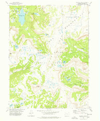
1977 Map of Trappers Lake
USGS Topo · Published 1978About this map
Trappers Lake and its surrounding high-altitude plateaus define this 1970s topographic study of the White River National Forest and Routt National Forest boundary. The landscape is characterized by the massive Flat Tops volcanic formation, which creates a series of steep escarpments and dramatic landmarks like the Chinese Wall and the Amphitheatre. Human presence is minimal, centered primarily on the Trappers Lake Campground and an extensive network of pack trails that weave through the wilderness to reach remote water bodies such as Wall Lake, Island Lake, and Mackinaw Lake. This map records the drainage patterns of the South Fork White River and Derby Creek, capturing a high-country terrain where travel was dictated by the gaps between peaks like Trappers Peak and Shingle Peak before more modern infrastructure reached deep into these protected lands.
Find a feature on this map
40 named features on this map. Tap any name to fly to it.
Don’t see what you’re looking for? This feature index may not catch every label — zoom into the map to look around manually.
Map Details
Editions of this 1977 Trappers Lake Map
3 editions found
Other maps of this area

1927 · Glenwood Springs
USGS Topo · 1:125,000

1930 · Glenwood Springs
USGS Topo · 1:125,000

1954 · Craig
USGS Topo · 1:250,000

1957 · Craig
USGS Topo · 1:250,000

1957 · Leadville
USGS Topo · 1:250,000

1958 · Craig
USGS Topo · 1:250,000

1959 · Leadville
USGS Topo · 1:250,000

1960 · Leadville
USGS Topo · 1:250,000

1960 · Craig
USGS Topo · 1:250,000

1962 · Leadville
USGS Topo · 1:250,000