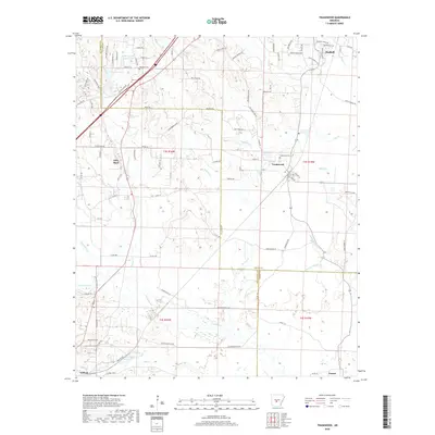
2020 Map of Traskwood
USGS Topo · Published 2020About this map
Haskell and Traskwood serve as the primary anchors of this Saline County landscape, where the terrain is defined by a dense network of creek drainages including Tenmile Cr and Holly Cr. The geography illustrates a transition from the structured residential roads of the north to the more agrarian and wooded spaces near Gifford and Fenter in the south. Local heritage is preserved at sites like Fairplay Cem and Traskwood Cem, while the inclusion of Pathway Youth Camp Lake and Dawson Lake points to the area's recreational and hydrological features. This map documents the complex boundary lines where Hot Spring, Saline, and Grant Counties meet, following the winding path of Francois Cr. The presence of several named lakes and smaller water bodies like Barr Lake suggest a landscape heavily influenced by local watersheds and the low-lying wetlands of Fletcher Slough.
Find a feature on this map
101 named features on this map. Tap any name to fly to it.
Don’t see what you’re looking for? This feature index may not catch every label — zoom into the map to look around manually.
Map Details
Editions of this 2020 Traskwood Map
This is the sole edition of this map. No revisions or reprints were ever made.
Other maps of this area

1890 · Benton
USGS Topo · 1:125,000

1894 · Benton
USGS Topo · 1:125,000

1938 · Benton
USGS Topo · 1:48,000

1944 · Benton
USGS Topo · 1:62,500

1944 · Benton
USGS Topo · 1:31,680

1948 · Malvern
USGS Topo · 1:62,500

1949 · Malvern
USGS Topo · 1:62,500

1955 · Little Rock
USGS Topo · 1:250,000

1956 · Little Rock
USGS Topo · 1:250,000

1960 · Little Rock
USGS Topo · 1:250,000