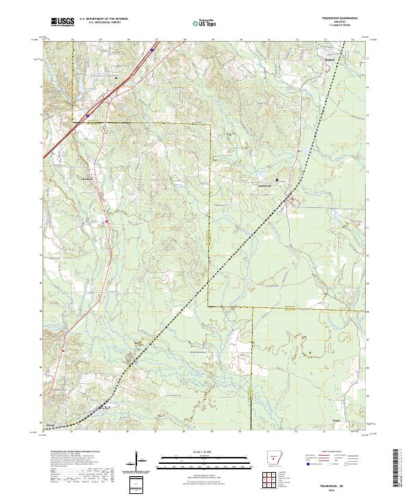
2024 Map of Traskwood
USGS Topo · Published 2024About this map
The junction of Saline, Hot Spring, and Grant counties forms the backdrop for this study of Central Arkansas drainage and settlement. The landscape is defined by the winding course of the Saline River in the southeast and the Gourdneck Valley to the northwest, with a dense network of tributaries including Tenmile Creek, Brushy Creek, and Chinquapin Creek carving through the terrain. The community of Traskwood serves as a central hub, flanked by Haskell and the settlement at Glen Rose. Local history is anchored by sites such as the Traskwood Cem and Fairplay Cem, while the historic Old Military Rd traces an older path through the region. The presence of Pathway Youth Camp near Camp Lake highlights the recreational and community use of the area's upland lakes like Dawson Lake and Barr Lake.
Find a feature on this map
108 named features on this map. Tap any name to fly to it.
Don’t see what you’re looking for? This feature index may not catch every label — zoom into the map to look around manually.
Map Details
Editions of this 2024 Traskwood Map
This is the sole edition of this map. No revisions or reprints were ever made.
Other maps of this area

1890 · Benton
USGS Topo · 1:125,000

1894 · Benton
USGS Topo · 1:125,000

1938 · Benton
USGS Topo · 1:48,000

1944 · Benton
USGS Topo · 1:62,500

1944 · Benton
USGS Topo · 1:31,680

1948 · Malvern
USGS Topo · 1:62,500

1949 · Malvern
USGS Topo · 1:62,500

1955 · Little Rock
USGS Topo · 1:250,000

1956 · Little Rock
USGS Topo · 1:250,000

1960 · Little Rock
USGS Topo · 1:250,000