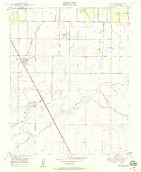
1949 Map of Traver
USGS Topo · Published 1959About this map
The Southern Pacific railroad corridor anchors this agricultural landscape in Tulare County, serving the small community of Traver and the nearby settlement of London. By the late 1940s, the region was defined by an intricate network of irrigation and drainage infrastructure, including the Traver Canal, Settlers Ditch, and Kennedy Waste Way. These man-made channels diverted water through the flat terrain to support the Central Valley's developing farm economy.
Find a feature on this map
30 named features on this map. Tap any name to fly to it.
Don’t see what you’re looking for? This feature index may not catch every label — zoom into the map to look around manually.
Map Details
Editions of this 1949 Traver Map
4 editions found
Other maps of this area

1922 · Trimmer
USGS Topo · 1:96,000

1923 · Sultana
USGS Topo · 1:31,680

1924 · Reedley
USGS Topo · 1:31,680

1924 · Selma
USGS Topo · 1:31,680

1924 · Dinuba
USGS Topo · 1:125,000

1926 · Goshen
USGS Topo · 1:31,680

1926 · Burris Park
USGS Topo · 1:31,680

1927 · Traver
USGS Topo · 1:31,680

1927 · Monson
USGS Topo · 1:31,680

1927 · Remnoy
USGS Topo · 1:31,680