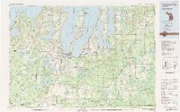
1983 Map of Traverse City
USGS Topo · Published 1984About this map
West Arm Grand Traverse Bay and East Arm Grand Traverse Bay frame the distinctive geography of this region, meeting at the hub of Traverse City. The 1980s landscape is defined by its deep relationship with water, from the massive Lake Michigan shoreline to the inland chain of lakes including Torch Lake, Elk Lake, and Lake Leelanau. Significant public lands such as Sleeping Bear Dunes National Lakeshore and the Pere Marquette State Forest preserve the natural character of the peninsula and mainland.
Find a feature on this map
119 named features on this map. Tap any name to fly to it.
Don’t see what you’re looking for? This feature index may not catch every label — zoom into the map to look around manually.
Map Details
Editions of this 1983 Traverse City Map
2 editions found

Other maps of this area

1949 · Black Creek
USGS Topo · 1:24,000

1949 · Fletcher
USGS Topo · 1:62,500

1950 · Fletcher
USGS Topo · 1:24,000

1954 · Central Lake
USGS Topo · 1:62,500

1954 · Traverse City
USGS Topo · 1:250,000

1954 · Escanaba
USGS Topo · 1:250,000

1954 · Manitowoc
USGS Topo · 1:250,000

1955 · Cheboygan
USGS Topo · 1:250,000

1956 · Alba
USGS Topo · 1:62,500

1956 · Mancelona
USGS Topo · 1:62,500
Featured Places
- Garfield Township, MI
- Garfield Charter Township, Garfield Township
- Traverse City, MI
- East Bay Township, MI
- East Bay Charter Township, East Bay Township