
1983 Map of Traverse City
USGS Topo · Published 1984About this map
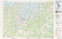
Traverse City serves as the focal point of this 1980s regional study, where the Boardman River meets the West Arm of the bay. The landscape is defined by the heavy presence of the Pere Marquette State Forest and the Sleeping Bear Dunes National Lakeshore, indicating a region deeply shaped by conservation and seasonal tourism. Transportation networks are well-established, featuring the Ann Arbor RR and the Chesapeake and Ohio RR cutting through the timberlands and connecting small settlements like South Boardman and Kingsley.
Find a feature on this map
243 named features on this map. Tap any name to fly to it.
Don’t see what you’re looking for? This feature index may not catch every label — zoom into the map to look around manually.
Map Details
Editions of this 1983 Traverse City Map
2 editions found
Other maps of this area

1949 · Black Creek
USGS Topo · 1:24,000

1949 · Fletcher
USGS Topo · 1:62,500

1950 · Fletcher
USGS Topo · 1:24,000

1954 · Central Lake
USGS Topo · 1:62,500

1954 · Traverse City
USGS Topo · 1:250,000

1954 · Escanaba
USGS Topo · 1:250,000

1954 · Manitowoc
USGS Topo · 1:250,000

1955 · Cheboygan
USGS Topo · 1:250,000

1956 · Alba
USGS Topo · 1:62,500

1956 · Mancelona
USGS Topo · 1:62,500
Featured Places
- Garfield Township, MI
- Garfield Charter Township, Garfield Township
- Traverse City, MI
- East Bay Township, MI
- East Bay Charter Township, East Bay Township