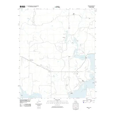
2010 Map of Trees
USGS Topo · Published 2010About this map
Caddo Lake dominates the southeastern quadrant of this Louisiana-Texas borderlands survey, defining a landscape of bayous and landings. The transition from terrestrial to aquatic environments is marked by settlements like Stacy Landing and Bonham Landing, while the Harts Ferry Bridge provides a crossing near Harold Creek. Local industry and infrastructure are prominent, with the Vivian Oil Field and Potter Oil Field indicating the region's petroleum history, supported by the Vivian Airport in the northeast.
Find a feature on this map
63 named features on this map. Tap any name to fly to it.
Don’t see what you’re looking for? This feature index may not catch every label — zoom into the map to look around manually.
Map Details
Editions of this 2010 Trees Map
This is the sole edition of this map. No revisions or reprints were ever made.
Other maps of this area

1932 · Hosston NW
USGS Topo · 1:31,680

1932 · Hosston SW
USGS Topo · 1:31,680

1944 · Kildare
USGS Topo · 1:62,500

1944 · Caddo Lake
USGS Topo · 1:62,500

1946 · Caddo Lake
USGS Topo · 1:62,500

1948 · Kildare
USGS Topo · 1:62,500

1948 · Mooringsport
USGS Topo · 1:62,500

1948 · Vivian
USGS Topo · 1:62,500

1955 · Shreveport
USGS Topo · 1:250,000

1955 · Mooringsport
USGS Topo · 1:62,500