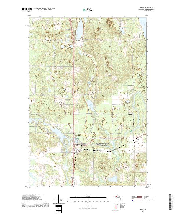
2022 Map of Trego
USGS Topo · Published 2022About this map
The Namekagon River snakes through the heart of this Washburn County landscape, protected within the Saint Croix National Scenic Riverway. This water-rich corridor is defined by the expansive Trego Lake and several spring-fed systems, including Whalen Springs and Veazie Springs. The settlement pattern is concentrated around the town of Trego and the smaller community of Earl, while the northern reaches remain sparsely populated around Lampson.
Find a feature on this map
84 named features on this map. Tap any name to fly to it.
Don’t see what you’re looking for? This feature index may not catch every label — zoom into the map to look around manually.
Map Details
Editions of this 2022 Trego Map
This is the sole edition of this map. No revisions or reprints were ever made.
Other maps of this area

1947 · Chittamo
USGS Topo · 1:48,000

1947 · Minong
USGS Topo · 1:48,000

1948 · Spooner
USGS Topo · 1:48,000

1948 · Stone Lake
USGS Topo · 1:48,000

1949 · Chittamo
USGS Topo · 1:48,000

1949 · Minong
USGS Topo · 1:48,000

1949 · Spooner
USGS Topo · 1:48,000

1950 · Stone Lake
USGS Topo · 1:48,000

1953 · Ashland
USGS Topo · 1:250,000

1953 · Rice Lake
USGS Topo · 1:250,000