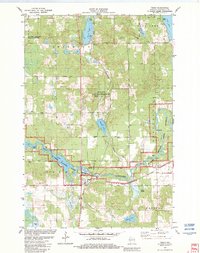
1982 Map of Trego
USGS Topo · Published 1982About this map
The confluence of the Namekagon River and the St Croix National Scenic Riverway anchors this portion of Washburn County, illustrating a landscape defined by glacial lakes and river corridors. The settlement of Trego serves as a central point where the Chicago and North Western rail line crosses the water, a route that also passes through the small communities of Lampson and Earl. These settlements are marked by local landmarks like the Lampson Cem and the Wesleyan Ch, providing specific points of interest for genealogical research.
Find a feature on this map
39 named features on this map. Tap any name to fly to it.
Don’t see what you’re looking for? This feature index may not catch every label — zoom into the map to look around manually.
Map Details
Editions of this 1982 Trego Map
This is the sole edition of this map. No revisions or reprints were ever made.
Other maps of this area

1947 · Chittamo
USGS Topo · 1:48,000

1947 · Minong
USGS Topo · 1:48,000

1948 · Spooner
USGS Topo · 1:48,000

1948 · Stone Lake
USGS Topo · 1:48,000

1949 · Chittamo
USGS Topo · 1:48,000

1949 · Minong
USGS Topo · 1:48,000

1949 · Spooner
USGS Topo · 1:48,000

1950 · Stone Lake
USGS Topo · 1:48,000

1953 · Ashland
USGS Topo · 1:250,000

1953 · Rice Lake
USGS Topo · 1:250,000