
1903 Map of Trent River
USGS Topo · Published 1961About this map
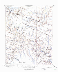
Trent River carves a winding path through the coastal lowlands of eastern North Carolina, serving as a primary corridor for commerce and transport at the beginning of the twentieth century. The river is lined with numerous historic river landings, such as White Bank Landing, Wooten Landing, and Murrill Landing, which once facilitated the movement of goods and people when water travel was vital. To the north, the Atlantic and North Carolina railroad cuts through the landscape, connecting the communities of Dover and Cove. Much of the northern terrain is dominated by the Great Dover Swamp, a massive pocosin landscape that significantly influenced early settlement patterns. Inland, small rural hubs like Phillips Crossroads and the county seat at Trenton act as anchors for the surrounding farmsteads and cypress runs.
Find a feature on this map
79 named features on this map. Tap any name to fly to it.
Don’t see what you’re looking for? This feature index may not catch every label — zoom into the map to look around manually.
Map Details
Editions of this 1903 Trent River Map
2 editions found
Other maps of this area

1901 · New Bern
USGS Topo · 1:62,500

1902 · Ayden
USGS Topo · 1:62,500

1902 · Vanceboro
USGS Topo · 1:62,500

1903 · New Bern
USGS Topo · 1:62,500

1904 · Ayden
USGS Topo · 1:62,500

1904 · Trent River
USGS Topo · 1:62,500

1904 · Vanceboro
USGS Topo · 1:62,500

1905 · Vanceboro
USGS Topo · 1:62,500

1914 · Kinston
USGS Topo · 1:48,000

1916 · Kinston
USGS Topo · 1:62,500