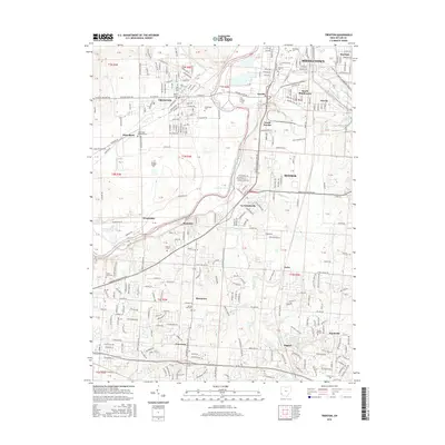
2016 Map of Trenton
USGS Topo · Published 2016About this map
The Great Miami River carves a central path through this portion of Butler County, anchoring a landscape defined by the industrial hubs of Middletown and Trenton. The river’s influence is seen in the clustering of small, distinct communities along its banks, including Woodsdale, Rockdale, and Le Sourdsville. This map provides significant genealogical value through its identification of numerous burial grounds, such as Baptist Cem, Saint Johns Cem, and the Augspurger Memorial Cem near Busenbark. The transition from the urban density of South Middletown to the more dispersed settlements of Maustown and Hughes reflects the area's mix of manufacturing growth and longstanding agricultural roots. Notable water features like Lesourdsville Lake, Lake Brenda, and Panther Run further detail the local topography and drainage patterns during this mid-2010s period.
Find a feature on this map
138 named features on this map. Tap any name to fly to it.
Don’t see what you’re looking for? This feature index may not catch every label — zoom into the map to look around manually.
Map Details
Editions of this 2016 Trenton Map
This is the sole edition of this map. No revisions or reprints were ever made.
Other maps of this area

1904 · Mason
USGS Topo · 1:62,500

1906 · Mason
USGS Topo · 1:62,500

1908 · Miamisburg
USGS Topo · 1:62,500

1911 · Oxford
USGS Topo · 1:62,500

1915 · Hamilton
USGS Topo · 1:62,500

1917 · Hamilton
USGS Topo · 1:62,500

1951 · Franklin
USGS Topo · 1:24,000

1953 · Cincinnati
USGS Topo · 1:250,000

1955 · Monroe
USGS Topo · 1:24,000

1955 · Hamilton
USGS Topo · 1:24,000