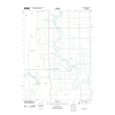
2011 Map of Trenton
USGS Topo · Published 2011About this map
Trenton and Cornish anchor this agrarian landscape along the Bear River, where a complex network of irrigation and water management supports the northern Utah valley. The West Cache Canal and West Canal parallel the river's winding course, illustrating the engineered hydrology essential to the region's agricultural productivity. Smaller settlements like Morton, Utida, and Cottle are spaced along the grid of county roads, while natural landmarks such as Little Mountain, Bergeson Hill, and Big Hill rise above the basin floor. Local history is anchored by the Trenton Cemetery, Cornish Cemetery, and Clarkston City Cemetery, which serve as permanent records of the families that established these communities. To the west, the Newton Reservoir and Newton Dam manage the flow of Newton Creek, marking a distinct shift from the river valley into the surrounding hollows like Butler Hollow and Pullum Hollow.
Find a feature on this map
60 named features on this map. Tap any name to fly to it.
Don’t see what you’re looking for? This feature index may not catch every label — zoom into the map to look around manually.
Map Details
Editions of this 2011 Trenton Map
This is the sole edition of this map. No revisions or reprints were ever made.
Other maps of this area

1914 · Logan
USGS Topo · 1:125,000

1915 · Preston
USGS Topo · 1:96,000

1916 · Logan
USGS Topo · 1:125,000

1918 · Preston
USGS Topo · 1:125,000

1954 · Pocatello
USGS Topo · 1:250,000

1954 · Ogden
USGS Topo · 1:250,000

1954 · Brigham City
USGS Topo · 1:250,000

1955 · Preston
USGS Topo · 1:250,000

1958 · Ogden
USGS Topo · 1:250,000

1958 · Pocatello
USGS Topo · 1:250,000