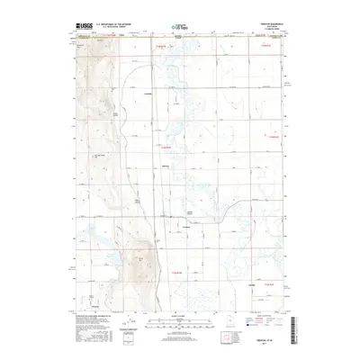
2017 Map of Trenton
USGS Topo · Published 2017About this map
Agricultural life in the Cache Valley is shaped by an extensive network of irrigation during this recent survey. The Bear River meanders through the center of the sheet, flanked by the West Canal and W Cache Canal, which provide critical water management for the surrounding farmland. Small settlements like Trenton, Cornish, and Amalga are linked by a grid of rural roads, including Creamery Rd and W Main St. For genealogists, the map identifies several local burial grounds, including Newton Cemetery, Trenton Cem, and Cornish Cem. The terrain rises to the west with landmarks such as Pete McCombs Hill and Bergeson Hill, while the Newton Reservoir and The Slough highlight the low-lying hydrologic features that define this borderland between Utah and Idaho.
Find a feature on this map
64 named features on this map. Tap any name to fly to it.
Don’t see what you’re looking for? This feature index may not catch every label — zoom into the map to look around manually.
Map Details
Editions of this 2017 Trenton Map
This is the sole edition of this map. No revisions or reprints were ever made.
Other maps of this area

1914 · Logan
USGS Topo · 1:125,000

1915 · Preston
USGS Topo · 1:96,000

1916 · Logan
USGS Topo · 1:125,000

1918 · Preston
USGS Topo · 1:125,000

1954 · Pocatello
USGS Topo · 1:250,000

1954 · Ogden
USGS Topo · 1:250,000

1954 · Brigham City
USGS Topo · 1:250,000

1955 · Preston
USGS Topo · 1:250,000

1958 · Ogden
USGS Topo · 1:250,000

1958 · Pocatello
USGS Topo · 1:250,000