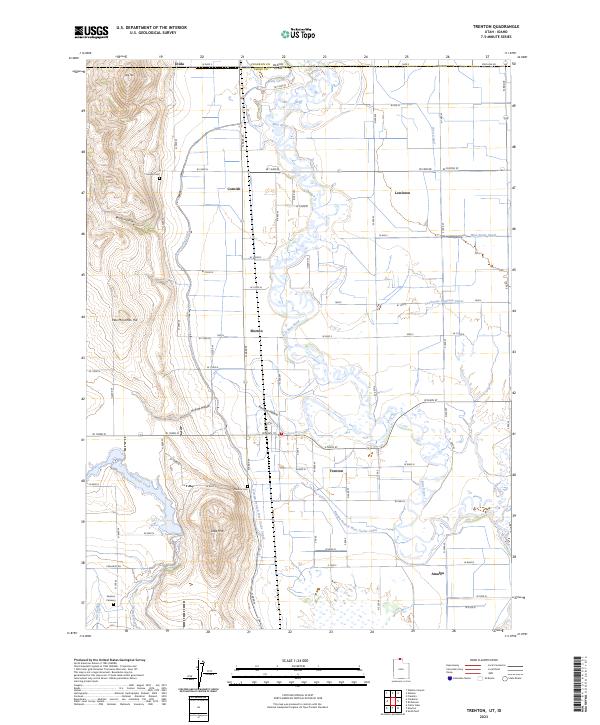
2023 Map of Trenton
USGS Topo · Published 2023About this map
Bear River dominates the center of this landscape, meandering through a complex network of irrigation infrastructure essential to northern Utah agriculture. The settlements of Trenton, Lewiston, and Cornish are defined by a rigid grid of rural roads, such as W Center St and W Main St, which organize the valley's farms. A series of specialized waterways, including the West Cache Canal, West Pump Canal, and the Amalga Branch West Cache Canal, illustrate the intensive water management required for local cultivation. Family and local history researchers will find the Cornish Cem, Trenton Cem, and Newton Cemetery preserved in their rural contexts. The western edge of the sheet rises toward Little Mtn and Pete McCombs Hill, providing a stark topographic contrast to the low-lying wetlands of The Slough.
Find a feature on this map
56 named features on this map. Tap any name to fly to it.
Don’t see what you’re looking for? This feature index may not catch every label — zoom into the map to look around manually.
Map Details
Editions of this 2023 Trenton Map
This is the sole edition of this map. No revisions or reprints were ever made.
Other maps of this area

1914 · Logan
USGS Topo · 1:125,000

1915 · Preston
USGS Topo · 1:96,000

1916 · Logan
USGS Topo · 1:125,000

1918 · Preston
USGS Topo · 1:125,000

1954 · Pocatello
USGS Topo · 1:250,000

1954 · Ogden
USGS Topo · 1:250,000

1954 · Brigham City
USGS Topo · 1:250,000

1955 · Preston
USGS Topo · 1:250,000

1958 · Ogden
USGS Topo · 1:250,000

1958 · Pocatello
USGS Topo · 1:250,000