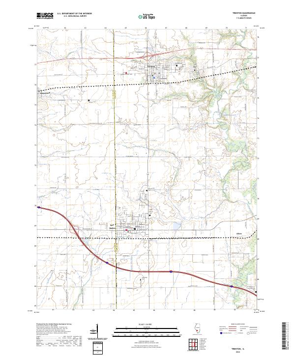
2024 Map of Trenton
USGS Topo · Published 2024About this map
Trenton and New Baden anchor this prairie landscape along the border of Clinton and St. Clair counties. The region is defined by its agricultural layout and numerous community landmarks, particularly the concentration of local burial grounds such as Saint Marys Cem and Saint George Cem. These sites, along with others like Wittmer Cem and Harpstrite Cem, serve as primary points of interest for genealogists tracing families in the Illinois heartland.
Find a feature on this map
80 named features on this map. Tap any name to fly to it.
Don’t see what you’re looking for? This feature index may not catch every label — zoom into the map to look around manually.
Map Details
Editions of this 2024 Trenton Map
This is the sole edition of this map. No revisions or reprints were ever made.
Other maps of this area

1906 · Breese
USGS Topo · 1:62,500

1907 · Breese
USGS Topo · 1:62,500

1907 · Belleville
USGS Topo · 1:62,500

1910 · Okawville
USGS Topo · 1:62,500

1912 · New Athens
USGS Topo · 1:62,500

1935 · Lebanon
USGS Topo · 1:24,000

1940 · Okawville
USGS Topo · 1:62,500

1949 · Lebanon
USGS Topo · 1:24,000

1949 · St. Jacob
USGS Topo · 1:24,000
1954 · Lebanon
USGS Topo · 1:24,000