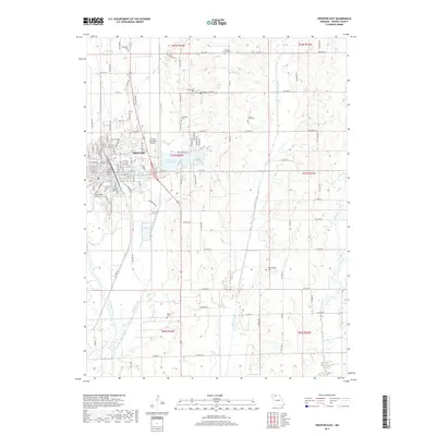
2017 Map of Trenton East
USGS Topo · Published 2017About this map
Trenton serves as the focal point of this Grundy County landscape, where the eastern edge of the city meets the winding courses of Muddy Creek and the Thompson River. The map reveals a community deeply rooted in its local institutions, from the campus of North Central Missouri Coll to the sprawling Trenton Municipal Airport. The eastern outskirts are defined by a series of recreation and utility sites, including Trenton Lower Lake and Trenton Upper Lake, while the surrounding rural townships are dotted with several family and community burial grounds such as Drummond Cem and Lancaster Cem. This 2017 survey details the modern layout of Us HWY 65 and Mo HWY 6, showing how these thoroughfares connect the urban core to the agricultural sections and drainage basins of Honey Creek.
Find a feature on this map
64 named features on this map. Tap any name to fly to it.
Don’t see what you’re looking for? This feature index may not catch every label — zoom into the map to look around manually.
Map Details
Editions of this 2017 Trenton East Map
This is the sole edition of this map. No revisions or reprints were ever made.
Other maps of this area

1921 · Chillicothe
USGS Topo · 1:62,500

1923 · Chillicothe
USGS Topo · 1:62,500

1924 · Chula
USGS Topo · 1:62,500

1946 · Galt
USGS Topo · 1:62,500

1947 · Chula
USGS Topo · 1:62,500

1948 · Trenton
USGS Topo · 1:62,500

1949 · Galt
USGS Topo · 1:62,500

1953 · Moberly
USGS Topo · 1:250,000

1954 · Centerville
USGS Topo · 1:250,000

1954 · Moberly
USGS Topo · 1:250,000