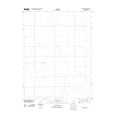
2011 Map of Trenton SW
USGS Topo · Published 2011About this map
North Fork Driftwood Creek meanders through the southern reaches of this landscape in Rawlins County, defining the drainage patterns of this high plains borderland. The topography is predominantly rural and agricultural, organized by a rigid section-line road network that includes Veterans Memorial Hwy and several numbered thoroughfares such as Street 1 and 6th Ave. A central water management feature, the Dahnke Reservoir, is held by the Dahnke Dam, providing a rare pocket of permanent surface water in this arid environment. This 2011 survey illustrates the modern rural infrastructure of the Kansas-Nebraska border region, where local access roads like Co Rd 316 connect isolated farmsteads to the larger regional highway system. The map captures the quiet, expansive character of the Great Plains, where development is sparse and tied closely to the intermittent watercourses and the established grid of county roads.
Find a feature on this map
11 named features on this map. Tap any name to fly to it.
Don’t see what you’re looking for? This feature index may not catch every label — zoom into the map to look around manually.
Map Details
Editions of this 2011 Trenton SW Map
This is the sole edition of this map. No revisions or reprints were ever made.
Other maps of this area

1950 · Mc Donald
USGS Topo · 1:62,500

1951 · Mc Donald
USGS Topo · 1:62,500

1951 · Atwood
USGS Topo · 1:62,500

1954 · McCook
USGS Topo · 1:250,000

1954 · Goodland
USGS Topo · 1:250,000

1956 · Goodland
USGS Topo · 1:250,000

1957 · McCook
USGS Topo · 1:250,000

1957 · Goodland
USGS Topo · 1:250,000

1958 · McCook
USGS Topo · 1:250,000

1962 · Trenton
USGS Topo · 1:24,000