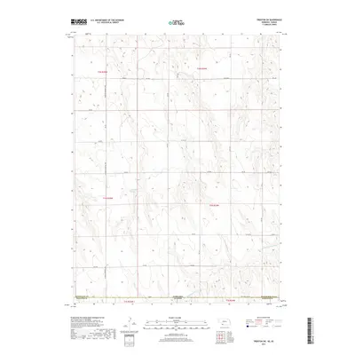
2017 Map of Trenton SW
USGS Topo · Published 2017About this map
The rolling plains of the High Plains straddle the Nebraska Kansas border in this 2017 survey of Rawlins County. This landscape is defined by the high-elevation drainage patterns of the N Fork Driftwood Cr, which cuts through the southern portion of the quadrangle. The Veterans Memorial Hwy serves as the primary north-south artery through this agricultural region, providing a modern connection between the disparate ranch and farm sections. Local water management is visible at Dahnke Reservoir, a significant catchment point in an otherwise arid environment. The map details a strictly organized grid of rural routes including Rd Ee and Ne State Line Rd, which mark the administrative transitions between Hitchcock Co and Rawlins Co. This edition captures the contemporary land use and boundary demarcations essential for understanding modern property lines and watershed management along the state line.
Find a feature on this map
28 named features on this map. Tap any name to fly to it.
Don’t see what you’re looking for? This feature index may not catch every label — zoom into the map to look around manually.
Map Details
Editions of this 2017 Trenton SW Map
This is the sole edition of this map. No revisions or reprints were ever made.
Other maps of this area

1950 · Mc Donald
USGS Topo · 1:62,500

1951 · Mc Donald
USGS Topo · 1:62,500

1951 · Atwood
USGS Topo · 1:62,500

1954 · McCook
USGS Topo · 1:250,000

1954 · Goodland
USGS Topo · 1:250,000

1956 · Goodland
USGS Topo · 1:250,000

1957 · McCook
USGS Topo · 1:250,000

1957 · Goodland
USGS Topo · 1:250,000

1958 · McCook
USGS Topo · 1:250,000

1962 · Trenton
USGS Topo · 1:24,000