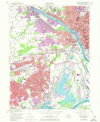
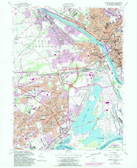
1955 Map of Trenton West
USGS Topo · Published 1972About this map
The Delaware River serves as the primary artery separating the urban core of Trenton from its expanding Pennsylvania suburbs in this mid-century survey. While the New Jersey side is densely packed with municipal infrastructure like the State Hospital, State Prison, and a complex grid of schools and churches including St Hedwigs Sch, the Pennsylvania side illustrates the rapid residential development of the post-war era. The planned layout of Levittown is clearly visible, organized into themed neighborhoods such as Appletree Hill, Lakeside, and Dogwood Hollow.
Find a feature on this map
143 named features on this map. Tap any name to fly to it.
Don’t see what you’re looking for? This feature index may not catch every label — zoom into the map to look around manually.
Map Details
Editions of this 1955 Trenton West Map
5 editions found
Other maps of this area

1888 · Bordentown
USGS Topo · 1:62,500

1888 · Princeton
USGS Topo · 1:62,500

1890 · Lambertville
USGS Topo · 1:62,500

1890 · Burlington
USGS Topo · 1:62,500

1891 · Lambertville
USGS Topo · 1:62,500

1893 · Bordentown
USGS Topo · 1:62,500

1893 · Burlington
USGS Topo · 1:62,500

1894 · Princeton
USGS Topo · 1:62,500

1894 · Lambertville
USGS Topo · 1:62,500

1904 · Burlington
USGS Topo · 1:62,500
Featured Places
- Hamilton Township, NJ
- Trenton, NJ
- Levittown, Bristol Township
- Middletown Township, PA
- Ewing Township, NJ