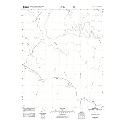
2011 Map of Tres Ritos
USGS Topo · Published 2011About this map
Rio Pueblo and Rio Grande del Rancho define the hydrologic character of this high-elevation terrain, where small settlements and seasonal recreation hubs are tucked into the canyons. The village of Tres Ritos sits at the southern edge of the sheet near Agua Piedra Campground, while further north along the river valley lie Las Mochas and Llanito Frio. The landscape is notably marked by industry and recreation, featuring the Sipapu Ski Area and a cluster of mineral resource sites including the Mica Mine, Tojo Mine, and US Hill Mine.
Find a feature on this map
48 named features on this map. Tap any name to fly to it.
Don’t see what you’re looking for? This feature index may not catch every label — zoom into the map to look around manually.
Map Details
Editions of this 2011 Tres Ritos Map
This is the sole edition of this map. No revisions or reprints were ever made.
Other maps of this area

1954 · Raton
USGS Topo · 1:250,000

1958 · Raton
USGS Topo · 1:250,000

1964 · Tres Ritos
USGS Topo · 1:24,000

1964 · Ranchos De Taos
USGS Topo · 1:24,000

1964 · Penasco
USGS Topo · 1:24,000

1964 · Taos SW
USGS Topo · 1:24,000
1964 · Jicarita Peak
USGS Topo · 1:24,000
1964 · El Valle
USGS Topo · 1:24,000

1965 · Holman
USGS Topo · 1:24,000

1965 · Shady Brook
USGS Topo · 1:24,000