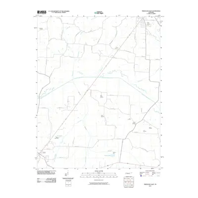
2010 Map of Trezevant East
USGS Topo · Published 2010About this map
The South Fork Obion River carves a broad valley through the center of this rural Carroll County landscape, flanked by a network of drainage tributaries including Elender Creek, Todd Creek, and Reedy Creek. This early 21st-century survey reveals a highly distributed agricultural community characterized by family-named roads and numerous small burial grounds that dot the countryside. Prominent genealogical sites like Union Academy Cemetery, Saint Johns Cemetery, and Mount Olive Cemetery serve as anchor points for the surrounding farmsteads. Local water management is visible through features like the Shoof Lake Dam and Presley Dam, which create small reservoirs such as Shoof Lake and Presley Lake amidst the flat creek bottoms. The infrastructure reflects a long-standing rural grid, with thoroughfares like Oak Grove Rd and St John Church Rd connecting the scattered residents to the nearby town centers just off the map's edge.
Find a feature on this map
52 named features on this map. Tap any name to fly to it.
Don’t see what you’re looking for? This feature index may not catch every label — zoom into the map to look around manually.
Map Details
Editions of this 2010 Trezevant East Map
This is the sole edition of this map. No revisions or reprints were ever made.
Other maps of this area

1936 · Center Ridge
USGS Topo · 1:24,000

1950 · Palmer Shelter
USGS Topo · 1:24,000

1955 · Henry
USGS Topo · 1:24,000

1955 · Huntingdon
USGS Topo · 1:24,000

1956 · Dyersburg
USGS Topo · 1:250,000

1956 · Blytheville
USGS Topo · 1:250,000

1959 · Blytheville
USGS Topo · 1:250,000

1966 · Mc Lemoresville
USGS Topo · 1:24,000

1966 · Atwood
USGS Topo · 1:24,000

1966 · Trezevant West
USGS Topo · 1:24,000