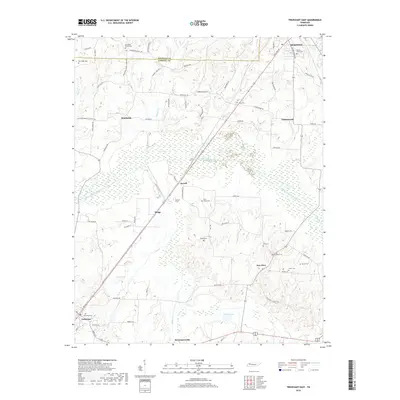
2019 Map of Trezevant East
USGS Topo · Published 2019About this map
The South Fork Obion River carves through this rural landscape in West Tennessee, where the Weakley and Carroll county line meets north of Hinkledale. Small agrarian settlements like Wingo, Jarrell, and New Zion are connected by a network of local roads including Hinkledale Rd and Enon Church Rd. The town of McKenzie anchors the northeastern corner, while Trezevant and McLemoresville sit along the southern boundary, reflecting the region's historic rail-and-road development. Numerous small cemeteries, such as Mount Olive Cem, Saint Johns Cem, and Union Academy Cem, are scattered across the terrain, serving as vital markers for genealogical research in this long-settled farming area. Low-lying wetlands and seasonal water bodies like Shoof Lake and Presely Lake punctuate the bottomlands along Halley Cr and Lick Cr.
Find a feature on this map
76 named features on this map. Tap any name to fly to it.
Don’t see what you’re looking for? This feature index may not catch every label — zoom into the map to look around manually.
Map Details
Editions of this 2019 Trezevant East Map
This is the sole edition of this map. No revisions or reprints were ever made.
Other maps of this area

1936 · Center Ridge
USGS Topo · 1:24,000

1950 · Palmer Shelter
USGS Topo · 1:24,000

1955 · Henry
USGS Topo · 1:24,000

1955 · Huntingdon
USGS Topo · 1:24,000

1956 · Dyersburg
USGS Topo · 1:250,000

1956 · Blytheville
USGS Topo · 1:250,000

1959 · Blytheville
USGS Topo · 1:250,000

1966 · Mc Lemoresville
USGS Topo · 1:24,000

1966 · Atwood
USGS Topo · 1:24,000

1966 · Trezevant West
USGS Topo · 1:24,000