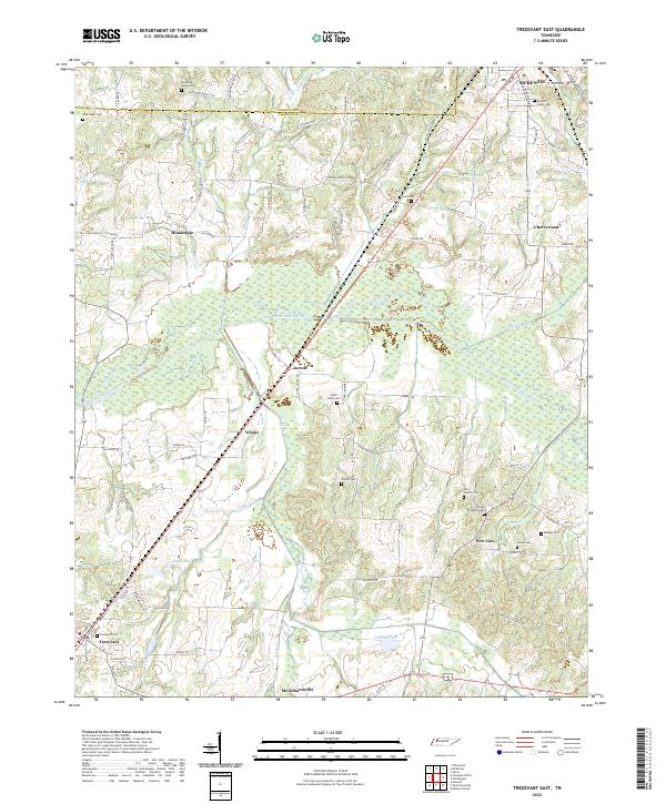
2022 Map of Trezevant East
USGS Topo · Published 2022About this map
The South Fork Obion River meanders through the heart of this landscape, carving a wide wetland basin across Carroll County. This drainage system dictates the placement of long-established communities like Jarrell and Wingo, which sit on the slightly higher ground bordering the river's floodplain. To the north, the city of McKenzie anchors the corner of the map near the Weakley County line, while Trezevant and McLemoresville define the southern reaches. This modern survey illustrates how early settlement patterns—preserved in the high density of family and community burial grounds—persist alongside contemporary infrastructure. Genealogists can trace a remarkable number of local landmarks, including the Mount Olivet Cem, Union Academy Cem, and Blooming Grove Cem, while the interior is dotted with water bodies such as Shoaf Lake and Presely Lake.
Find a feature on this map
90 named features on this map. Tap any name to fly to it.
Don’t see what you’re looking for? This feature index may not catch every label — zoom into the map to look around manually.
Map Details
Editions of this 2022 Trezevant East Map
This is the sole edition of this map. No revisions or reprints were ever made.
Other maps of this area

1936 · Center Ridge
USGS Topo · 1:24,000

1950 · Palmer Shelter
USGS Topo · 1:24,000

1955 · Henry
USGS Topo · 1:24,000

1955 · Huntingdon
USGS Topo · 1:24,000

1956 · Dyersburg
USGS Topo · 1:250,000

1956 · Blytheville
USGS Topo · 1:250,000

1959 · Blytheville
USGS Topo · 1:250,000

1966 · Mc Lemoresville
USGS Topo · 1:24,000

1966 · Atwood
USGS Topo · 1:24,000

1966 · Trezevant West
USGS Topo · 1:24,000