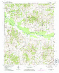
1966 Map of Trezevant West
USGS Topo · Published 1985About this map
The South Fork Obion River meanders across this rural landscape where the borders of Weakley, Carroll, and Gibson Counties converge. Surveyed in the mid-1960s with updates through the 1980s, the map reveals a settlement pattern defined by small rural hubs such as Staffords Store, Holly Leaf, and the established town of Christmasville. The area's social fabric is anchored by a dense network of country churches, including New Prospect Ch, Pilgrims Rest Ch, and Republican Grove Ch, many of which are accompanied by local cemeteries. Transportation is dominated by the Seaboard rail line cutting through the southeast corner near Trezevant, while numerous small waterways like Bear Creek, Plum Creek, and Cane Creek drain the wooded bottomlands and agricultural fields that characterize this West Tennessee region.
Find a feature on this map
26 named features on this map. Tap any name to fly to it.
Don’t see what you’re looking for? This feature index may not catch every label — zoom into the map to look around manually.
Map Details
Editions of this 1966 Trezevant West Map
2 editions found
Other maps of this area

1952 · Milan
USGS Topo · 1:24,000

1954 · Greenfield
USGS Topo · 1:24,000

1954 · Bradford
USGS Topo · 1:24,000

1956 · Dyersburg
USGS Topo · 1:250,000

1956 · Blytheville
USGS Topo · 1:250,000

1959 · Blytheville
USGS Topo · 1:250,000

1966 · Mc Lemoresville
USGS Topo · 1:24,000

1966 · Atwood
USGS Topo · 1:24,000

1966 · Trezevant West
USGS Topo · 1:24,000

1967 · Pillowville
USGS Topo · 1:24,000