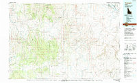
1990 Map of Triangle
USGS Topo · Published 1990About this map
The Owyhee Mountains dominate this high-desert landscape in southwestern Idaho, a region defined by deeply incised canyons and high basalt plateaus. At the time of this 1990 revision, the isolated settlement of Triangle and the riverside community of Grand View serve as primary landmarks in a territory largely shaped by the cattle industry and legacy mining. Resource extraction is evidenced by the Black Warrior Mine and Bluebird Mine, located among the complex drainage networks of Silver City and Jordan Creek.
Find a feature on this map
54 named features on this map. Tap any name to fly to it.
Don’t see what you’re looking for? This feature index may not catch every label — zoom into the map to look around manually.
Map Details
Editions of this 1990 Triangle Map
This is the sole edition of this map. No revisions or reprints were ever made.
Other maps of this area

1892 · Mountain Home
USGS Topo · 1:125,000

1892 · Bisuka
USGS Topo · 1:125,000

1892 · Silver City
USGS Topo · 1:125,000

1893 · Mountain Home
USGS Topo · 1:125,000

1894 · Bisuka
USGS Topo · 1:125,000

1894 · Silver City
USGS Topo · 1:125,000

1898 · Silver City
USGS Topo · 1:125,000

1946 · Mouth of Bruneau
USGS Topo · 1:24,000

1947 · Little Valley
USGS Topo · 1:24,000

1947 · Grand View
USGS Topo · 1:62,500