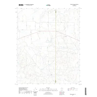
2019 Map of Triangle Ranch
USGS Topo · Published 2019About this map
Triangle Ranch anchors this portion of the Rolling Plains, marking a landscape defined by cattle ranching and water management in the arid borderlands of Cottle and Foard Counties. The territory is characterized by a complex network of ephemeral drainages, including the E Prong Catfish Cr and Talking John Cr, which feed into the larger system of Good Cr. To support livestock across these drainages, the map details numerous named water catchments such as Matador Tank, Charley Hart Tank, and Beef Pasture Tank. This network of tanks illustrates the essential infrastructure required for large-scale ranching in West Texas. Rising above the draws and plains, Marys Peak serves as a primary topographic landmark in an area otherwise dominated by the winding beds of E Cottonwood Cr and a grid of rural county roads.
Find a feature on this map
26 named features on this map. Tap any name to fly to it.
Don’t see what you’re looking for? This feature index may not catch every label — zoom into the map to look around manually.
Map Details
Editions of this 2019 Triangle Ranch Map
This is the sole edition of this map. No revisions or reprints were ever made.
Other maps of this area

1927 · Quanah 3-b
USGS Topo · 1:48,000

1932 · Vivian
USGS Topo · 1:62,500

1954 · Lubbock
USGS Topo · 1:250,000

1954 · Plainview
USGS Topo · 1:250,000

1954 · Wichita Falls
USGS Topo · 1:250,000

1955 · Lawton
USGS Topo · 1:250,000

1958 · Wichita Falls
USGS Topo · 1:250,000

1958 · Plainview
USGS Topo · 1:250,000

1960 · Teacup Mountain
USGS Topo · 1:62,500

1967 · Triangle Ranch
USGS Topo · 1:24,000