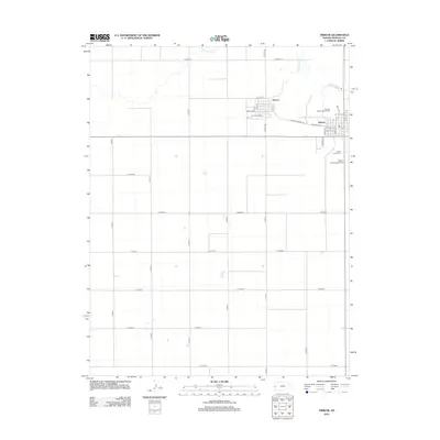
2012 Map of Tribune
USGS Topo · Published 2012About this map
Tribune serves as the primary center of activity in this high plains landscape, situated at the junction of several key local routes including Horace-Tribune Rd and W Greeley Ave. The town is the site of the Po and the Greeley County Fairgrounds, reflecting its role as a regional hub for the surrounding agricultural community. Just to the northwest, the smaller settlement of Horace is laid out with a distinct grid featuring streets named after states and numbers, such as Kansas Ave, Iowa Ave, and 7th St.
Find a feature on this map
35 named features on this map. Tap any name to fly to it.
Don’t see what you’re looking for? This feature index may not catch every label — zoom into the map to look around manually.
Map Details
Editions of this 2012 Tribune Map
This is the sole edition of this map. No revisions or reprints were ever made.
Other maps of this area

1955 · Scott City
USGS Topo · 1:250,000

1958 · Scott City
USGS Topo · 1:250,000

1970 · Selkirk SW
USGS Topo · 1:24,000

1970 · Sharon Springs 3 SE
USGS Topo · 1:24,000

1970 · Sharon Springs 4 SW
USGS Topo · 1:24,000
1970 · Sharon Springs 3 SW
USGS Topo · 1:24,000

1970 · Selkirk NW
USGS Topo · 1:24,000
1970 · Tribune NW
USGS Topo · 1:24,000

1970 · Tribune SE
USGS Topo · 1:24,000
1970 · Tribune SW
USGS Topo · 1:24,000